-
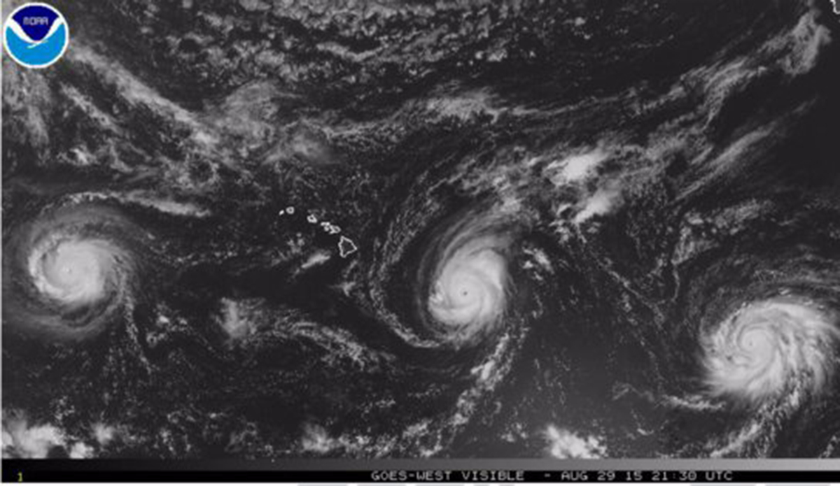
Early images of Hurricanes Kilo, Ignacio and Jimena on August 29, 2015. Photo: NASA
-
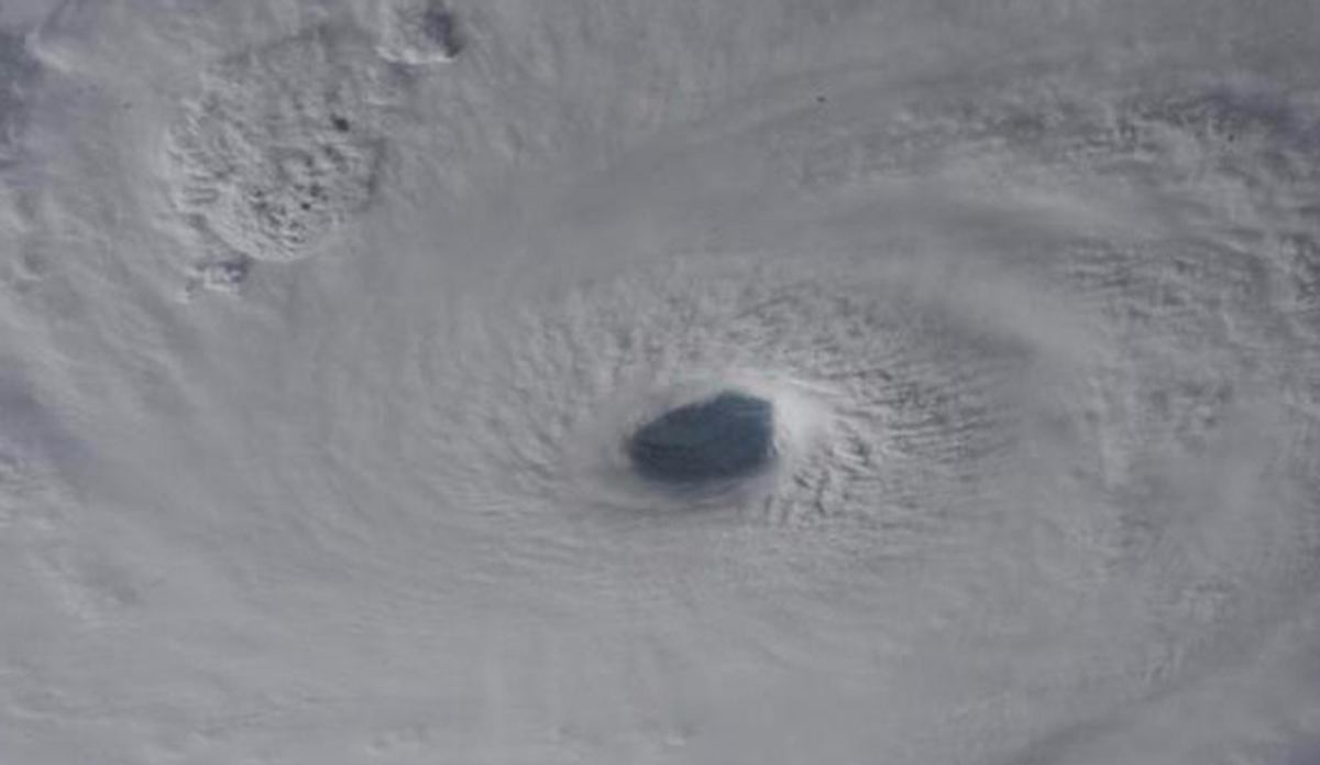
A close up image of the eye of Hurricane Jimena as seen from the Internatonal Space Station. (Photo: NASA/ Kjell Lindgren)
-
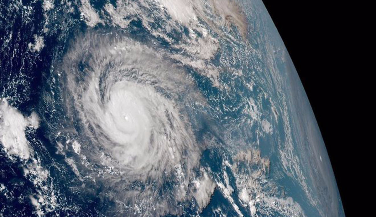
Hurricane Kilo (left) and Hurricane Ignacio (far right edge) swirl in the Pacific (Photo: Himawari-8 Satellite, via Twitter user @islivington)
-
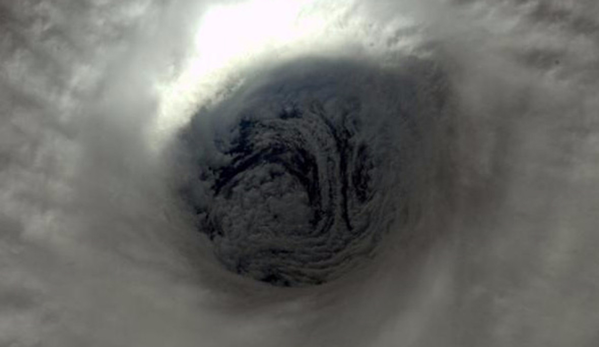
A close up image of the eye of Hurricane Jimena as seen from the Internatonal Space Station. (Photo: NASA/ Kjell Lindgren)
-
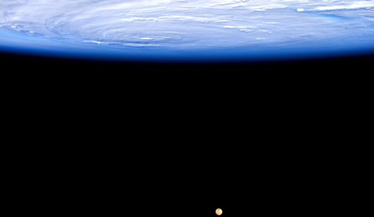
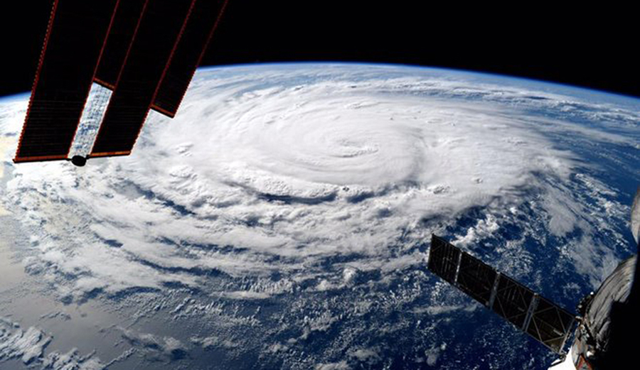
Hurricane Jimena as seen from the Internatonal Space Station. (Photo: NASA/ Scott Kelly)
-
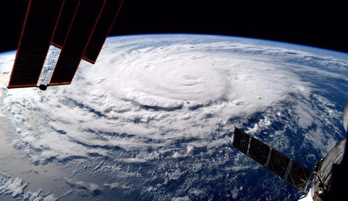
Hurricane Jimena as seen from the Internatonal Space Station. (Photo: NASA/ Kjell Lindgren)
-
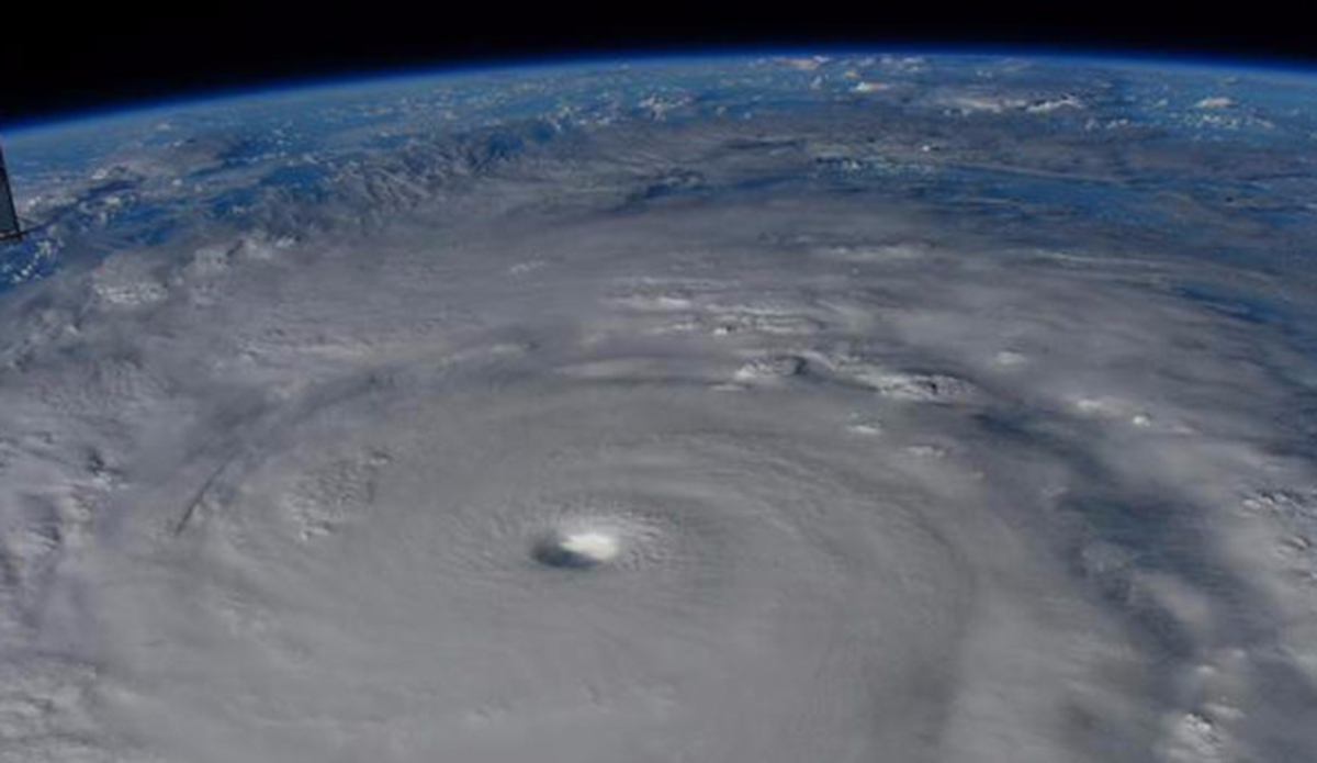
A close up image of the eyewall of Hurricane Jimena as seen from the Internatonal Space Station. (Photo: NASA/ Kjell Lindgren)
Images like these have never been taken or seen before. The Pacific is experiencing warmer than normal sea surface temperatures, making the world’s largest ocean a gold mine for hurricane activity this late in the summer. So when three category four hurricanes started parading above waters the trio of storms created a historical first in recorded history. That news was incredible enough when Hurricane Kilo, Hurricane Ignacio and Hurricane Jimena first popped into our news feeds. But now NASA is offering us the first look at real photos of the event taken from space.
If this is how we’re kicking off an expected El Nino this could be one heck of a winter coming our way.